
|
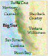
Table of
Contents
|
|
3
Point Lobos
5
Garrapata
8
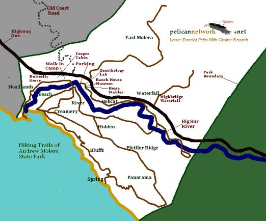
Andrew Molera
13
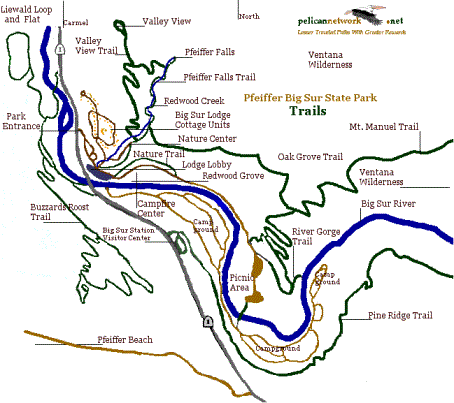
Pfeiffer Big Sur
16
Julia
Pfeiffer Burns
29
Limekiln
Maps
Big Sur
History
People
of Big Sur
Getting
Around Big Sur
Wildlife
of Big Sur
Native
Plants
Redwoods
Rich
Marine Environment
Backcountry
Songbird
Banding
Where to
eat
|
|
|
By
Jack Ellwanger and Margie Whitnah
PelicanNetwork
PO Box 222224
Carmel, CA 93922
Big Sur Coast Trail
Collaborative
Community-based
initiative to complete the California Coastal
Trail
PelicanNetwork.net
/bscoasttrail.htm
To order
copies of Big Sur Coast Trail Guide
call 831 667 2025
|
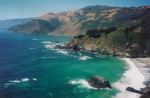
Wondrous scenery and amazing biodiversity in the Santa
Lucia Mountains along the coast make Big Sur a treasure
of nature.
Good
trails and spectacular country.
Not as high, but
steeper than the Sierra, and more diverse. Big Sur and
the Ventana Wilderness offer challenges. The broad
biodiversity, newborn geology, and the closeness of the
ocean all combine to engage your senses in unexpected
ways.
Page Two
|
|
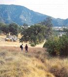
Point Lobos
State Reserve
2 miles south of
Carmel’s Rio Road
$8 Park entrance fee per car
|
Point
Lobos
is the product of
complex geology. Blocks of earth from three miles
deep, parts of the Sierra Nevada mountains and some
Pacific islands off southern Mexico collided here.
The sparkling granite cliffs that came from deep
beneath the sea, emerged as molten lava and cooled
very slowly. Here the unique geology cleanses the
sea. A great progression of change is evident in
the meadows and coves throughout Point
Lobos.
This is another world, and
it seems that each step brings a hiker to yet
another visual wonder.
Mercifully spared the
developer’s bulldozer early in the last century,
Point Lobos has been preserved as a California
State Reserve.
Its rare beauty and unique
biology have made it a symbol of California Parks
and the Monterey Bay National Marine
Sanctuary.
It may seem peaceful now,
but Point Lobos has a raucous history.
|
|
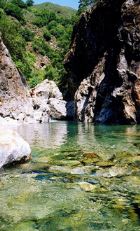
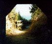
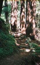
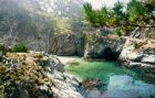 China
Cove China
Cove
Photo by Jack
Ellwanger
|
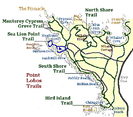
In the more than 750 land
acres of Point Lobos State Reserve, there are 14
trails covering 6 miles.
The hikes along the coast
are stunningly beautiful…along ledges through
ancient cypress overlooking storybook coves…unto
headlands lavished in rare flora and staged with
great birds. The hikes inland into meadows and
forests are more subtle and yet filled with intense
nature.
An excellent trail map and
description is available at the Ranger Station at
the entrance to the Reserve. There’s a fee for
vehicles – but no fee to bicycle or to walk in. If
110 visitor vehicles are already in the reserve,
more will not be let in until those earlier cars
leave. That situation can often happen early when
the weather is nice.
Point Lobos State Reserve
opens at 9:00 a.m. Visitors must leave the Reserve
by the closing time listed
Winter closing time –
Pacific Standard Time: begins Sunday, October 29,
2006
No admittance after 4:30
P.M.
Summer closing time –
Daylight Savings Time: begins Sunday, March 11,
2007
No admittance after 6:30
P.M., all visitors must exit by 7 P.M. at the
Ranger Station.
Be well-prepared for
taking photos, as there are far more photographic
opportunities than you can imagine.
|
|
|
|
|
Page Three
|
|
North Shore Trail
Along the Carmel Bay, starting at Whaler’s
Cove, this trail quickly ascends to great views of
isolated beaches filled with steller seals (Lobos
marinos – the name given to the sea lions by the
Spanish). On this very gratifying 1.5-mile hike,
you’ll see tantalizing sights of offshore rock
islands, ancient trees, nesting sea birds.
Note: Visit
the Whaling Museum at Whaler’s Cove – Along with a
great collection of cultural and natural history,
it includes a lot of movie memorabilia from films
made here.
Sea
Lion Point
Trail
A half-mile trail to incredible ocean views and
a good look at the reserve’s plant communities and
geology. Wheelchair accessible.
|
|
|
Bird
Island
Trail
A 3.5-mile loop trail to sea otters and birds.
It includes a loop trail down to Gibson Beach and
back.
South Shore
Trail crosses a rocky area to a bluff
where you can see Bird Island. It passes two
idyllic, sandy beaches accessed by wooden
stairs.
Bring binoculars. Watching the life on Bird
Island can be enthralling.
Cypress Grove
Trail
On this trail, you can hike to the Allan
Memorial Grove. This magnificent grove of Monterey
Cypress — one of only two natural groves remaining
in the world — is a tribute to the Allan family
which worked diligently to buy lots of the proposed
subdivision so the grove could be saved.
|
|
Page Four
|
|
Garrapata
State Park
7 miles south
of
Carmel’s Rio Road
Garrapata State Park has a
wonderfully scenic stretch of coastal area that
lures Big Sur travelers to stop and visit.
Garrapata is only 7 miles south of Carmel Valley
Road and 14 miles north of Andrew Molera State
Park. Many visitors take time to linger a bit,
enjoying the classic Big Sur shoreline here with
its rugged rocks, waves surging and crashing, kelp
beds undulating, sea lions barking, gray whales
migrating, seabirds diving and wildflowers
thriving. However, many fewer visitors know about,
nor take the time to hike, the marvelously
rewarding trails of Garrapata State Park. There are
two longer inland trails on the east side of
Highway One and also an easy, 2-mile loop trail
along the coastal bluffs.
|
|
Rocky Ridge
Trail
A rustic, broken-down barn and large grove of
old cypress signal the stop for the trailheads of
Garrapata’s inland trails. The northernmost one is
the Rocky Ridge Trail, on which energetic hikers
have options, including a 6 mile out-and-back
outing, or a 4.6 mile loop which returns via
Soberanes Canyon Trail. Hikers choosing to begin
the loop via the Rocky Ridge Trail can start along
the trail behind the barn, crossing willow-lined
Soberanes Creek, then going a short way to the
Soberanes Canyon Trail junction (which turns
right). At that point the Rocky Ridge Trail is to
the left, heading north.
|
|
|
Those Rocky Ridge hikers choosing to hike in 3
miles will walk by coastal scrub up steep trails
with spectacular vistas, at first of the shoreline
and coastal Santa Lucias. In spring the grasses
host lovely wildflowers. Rugged, lichen-covered
boulders and rock outcroppings stand out among the
grasses. One overlook has a welcome bench to rest
upon. When reaching about 1,600 feet in elevation,
views of the whole Monterey Bay and coastline are
possible on clear days.
Those hiking on to Doud Peak at the end of the
trail may even view central coast peaks to the
east.
It is debatable whether or not hiking up the
Rocky Ridge Trail is the best direction to start,
since returning on the loop via the Rocky Ridge
Trail would give hikers a constant view of the
coast while descending.
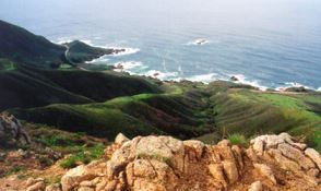
|
 Photo
by Margie Whitnah Photo
by Margie Whitnah
|
|
|
Page Five
|
|
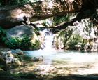
Soberanes Canyon
Trail
Approaching the Soberanes Canyon Trail from the
Rocky Ridge Trail brings the hiker’s perspective
from a broad, almost 360-degree view of the
northern coastal Santa Lucia range, with hillsides
folding and rolling toward the sea, to a narrower
perspective as one drops into the watershed of a
redwood-filled canyon. The steep trail quickly
descends an elevation of 1,200 feet from the Rocky
Ridge Trail to the canyon of majestic Sequoia
sempervirens. Along the way, admiring wildflowers
that may be blooming or, once in the canyon, the
variety of ferns, make for pleasant hiking breaks.
The cool, bubbling creek under the redwoods, passes
by large boulders, some of which may reveal to
observant visitors, the grinding areas of
indigenous people.
Hikers can expect a variety of creek crossings
in following the trail among the coast redwoods,
tanoak, California bay, madrone, buckeye, willows,
berry bushes, and other native and non-native
plants as the hikers trek toward the coast.
Particularly noteworthy non-natives are the
dense hillsides of prickly pear cactus. The cacti
have taken on a life of their own starting from the
days early settlers introduced them into this
area.
|
|
Hiking the last part of the 3-mile long
Soberanes Canyon Trail has some other botanical
surprises in the form of calla lilies that seemed
to have spread from the historic old farm area
which was once part of a Mexican land grant, and
later part of property owned under names such as
Post, Soberanes, and Doud. After pondering the
building remains, fences, and indications of
inhabitants of yesteryear, yet another marine trail
and experiences await hikers across Highway
One.
|
|
|
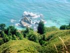
Soberanes
Point (Whale Peak)
This distinctive headland, a gentle cone
peaking out of the oceanscape with a
mountain backdrop, gives one a
comprehensive and dramatic look at Big Sur
coastline. It’s a short (1 mile) trail
that winds around the peak. It goes
through several coastal botanical and
intertidal zones. It ends at a view point
on top that gives one a heart-stopping
view of the Big Sur coast.
Soberanes Point Trail begins 6.7 miles
south of Carmel’s Rio Road on Highway One.
At this point, on the east side of the
road, is the trail into the mouth of
Soberanes Canyon.
Both trails traverse expanses of
non-native plants. Two local groups, Chuck
Haugen Conservation Fund and California
Native Plant Society, along with
California Department of Parks, have
vigorously fought back the invasion of
invasive species and the area is slowly
returning to a native state.
|
|
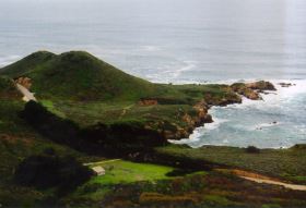
Photo by Margie
Whitnah
|
|
Whale Peak
Soberanes was used during summer by Rumsens (a
subgroup of Ohlone) and other Native Californians.
Their diet consisted of mussels, abalone, sea
lions, deer, rabbits, acorns and buckeye seeds.
|
|
 Photo
by Margie Whitnah Photo
by Margie Whitnah
Rough boulders preside over whimsical canyons.
Crystals glisten in a mosaic of wildflowers and lush sea
blues. Quartz diorite, a type of granitic rock, sparkles
in the northern Santa Lucia Range. Rusty hewn rocks on
the ridge are intertwined with granite boulders that form
the ramparts of the coastal coves. Of the whole 90-mile
Big Sur coast, the formation and interaction of land and
sea is nowhere so poignantly portrayed as in Soberanes
Canyon.
Page Six
|
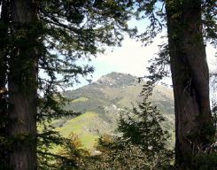
Photo by Margie
Whitnah
Pico Blanco through redwoods. Nearly 4,000 feet
high, this mountain of marble was thought to be the place
of human creation by Native Americans of the area.
|
Bird
Notes by Jeff Davis
and Don Roberson
Garrapata is home to the local breeding race of
the White-crowned Sparrow (“Nuttall’s” form).
Lazule Bunting and Orange-crowned Warbler are
present during summer, and Wrentit, Spotted Towhee,
and Bewick’s Wren are present year round.
|
This can also be a good place for viewing
Brandt’s Cormorant, Pelagic Cormorant, and Pigeon
Guillemot. The trail inland along Soberanes Creek
can be good for migrant vireos and warblers.
Costa’s Hummingbird, Rock Wren, MacGillivray’s
Warbler, and Black-chinned Sparrow have bred within
Soberanes Canyon.
|
Page Seven
|
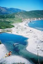
Andrew
Molera State Park
21 miles
south of
Carmel’s Rio Road
|
Seven and a half square miles of wilderness,
along the ocean, into the mountains, and complete
with a wild and scenic river – Andrew Molera State
Park is a great favorite for outdoor enthusiasts.
The entrance is three miles south of Point Sur and
4.5 miles north of Pfeiffer Big Sur State Park. An
$8 per car fee is collected at the parking lot
entrance. Guests at the Big Sur Lodge have free
entrance to all Big Sur coast state parks during
their stay at the Lodge.
A variety of interesting trails, most with
incredible views, and a 24-site walk-in campground
make Molera an engaging place to stay awhile.
The park is dissected by the Big Sur River. Long
stretches of marine terrace, vast sweeps of beach,
expansive scapes of wildflowers, hillsides of
coastal scrub, and deep old-growth redwood and oak
forests make Molera an imagination-bending
experience.
|
|
|
How the pristine Big Sur River winds from the
Ventana highlands to the sea is a rare California
natural prize. Big Sur River has no dams, nor any
man-made diversions. It is thoroughly untamed and
wonderful, it is instructive and magical all at
once. How it enters the Pacific at the Headlands is
a raucous and lovely place. This is one of the
liveliest wild bird encounters on the whole Pacific
coast. And, all along the river you walk among one
of the most precious and populated songbird
habitats anywhere.
Molera is a treasure, and there are many trails
inviting you in. Among its many attributes, it is a
very rewarding birdwatching area.
Across Highway One from the Molera entrance, the
10-mile Old Coast Road begins its backcountry wind
to the Bixby Bridge through a redwood forest.
|
|
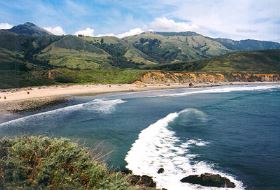
Photo by Margie
Whitnah
Page Eight
|
|
Headlands
Trail
From the north end of the Andrew Molera parking
lot, the Headlands Trail winds along the north bank
of the Big Sur River.
This trail is a treat of diversity. It gives you
great looks into ancient, huge and wondrously
twisted oaks, into the sparkling river; a large
meadow with quail, deer and a dispersed campground;
views of Pico Blanco; a mid-1800’s homestead cabin;
a winter Monarch Butterfly habitat in a large blue
gum eucalyptus grove; riparian forest of alders and
willows; sea stacks called Sur Breakers here and
home to cormorants; extensive kelp forests; river
lagoon home to large colonies of ducks, sea and
shore birds; and, lovely headlands with many Indian
middens.
Along the lower Big Sur River, the trail offers
rare encounters with many bird species: chickadees,
bushtits, warblers and many other songbirds, belted
kingfishers, red-shouldered hawks, kites, kestrels,
and golden eagles.
At the headlands there are views up and down the
coast and to the mountains of the Santa Lucia
Coastal Range. Offshore, California gray whales are
seen during their winter migration south to Baja
California lagoons, and Spring return to the
Arctic.
This trail is one mile, and easy. But it can be
uncomfortable when cold and windy.
Beach Trail
Loop
An easy, nearly 2-mile walk along the Big Sur
River through riparian thicket, along a vast and
fascinating beach and back through a bird watching
paradise in a restored meadow.
|
Photo at right: Bluffs
Trail seen from above Big Sur River lagoon at Headlands
Trailhead.
|
|
Creamery
Trail
Return by reversing to the Creamery Trail junction.
Once a milk cow pasture, the meadow is being
restored to its native state by the California
Department of Parks. It’s a massive job to
revegetate the meadow with native plants, but the
progress to date is inspiring.
In this trail loop you might see bobcats and
coyotes, and probably will see lizards, rabbits,
and deer.
Beginning at the parking lot area’s picnic site,
cross the river at the footbridge, which is
constructed annually before Memorial Day and
removed after Labor Day. Beach Trail begins on the
right at the trail fork. Follow it to the beach.
Before reaching the beach the Creamery Trail
junctions with the Beach Trail. Continue on to
experience one of California’s most scenic and
dramatic beaches. Molera Beach spans 2.5 miles from
the Headlands at the Big Sur River lagoon at the
river’s mouth, south to Cooper Point.
To the north there are whimsical collections of
driftwood, and great waves to the south. It is
beautiful.
|
 Photo
by Jack Ellwanger Photo
by Jack Ellwanger
|
|
Page Nine
|
|
Ridge, Panorama,
Spring and Bluffs Trail Loop
For those wanting a full day hike with
incredibly diverse sights, flora and elevations,
taking a loop hike which includes these four Molera
State Park trails will guarantee a memorably
rewarding outing.
This loop hike, in the neighborhood of 8 miles,
can be done in either direction, but this
description will follow in order the Ridge,
Panorama, Spring, and Bluffs Trails. The loop can
also be started from various places in the park,
but this description assumes that hikers will start
near the northwestern end of the Ridge Trail
(closest to Molera Beach). Trails that meet at,
near, or en route to the Ridge Trail junctions
include: Beach and Creamery Meadows loop trails and
the Bluffs Trail. Looking at a map, hikers will
also note that about a third of the way up the
Ridge Trail, the Hidden Trail, runs into the Ridge
Trail, providing yet another option.
To begin this loop hike, hikers need access to
the trails on the park’s more southern, coastal
side of the Big Sur River. Many months of the year,
hikers can do this hike by crossing the Big Sur
River at the parking lot’s picnic area by using a
temporary bridge or by wading across the river if
it isn’t running too high or too swiftly. The water
can be quite chilly and the rocks in the river bed
can be more tolerable when some sort of footwear is
worn. Another way that some hikers access the
trails for this loop trip, is to cross the river by
fording it at the Big Sur River mouth. Always check
with the staff at the park’s kiosk for advice first
about the tides at the river mouth or current
safety conditions for river crossings, if the
narrow footbridge is not up.
Once hikers have navigated any waterways, walked
the earlier described “flatland” trails (Headlands,
Creamery Meadow, River or Hidden Trails) and
reached a junction of the Ridge Trail near Molera
Beach, this “four-trail” loop hike can begin.
Before starting, hikers may want to visit
Molera Beach briefly to appreciate the beauty of
the beach, waves, river mouth, headlands, coastal
bluffs and vistas. Returning to the nearby trails
that meet up with the Ridge Trail, hikers will
re-visit many of the native plants and shrubs that
were seen on their stroll from the parking lot to
the beach and bluff area.
|
|
|
The 2.7 mile Ridge
Trail starts out fairly flat, among the
splendid array of relatively low-lying vegetation
mentioned in the earlier descriptions of the park’s
river land area. As this wide trail (previously a
fire road) climbs steadily uphill, the views of
prominent peaks to the east, the coast and river
mouth become awesome. The views only diminish when
hikers begin entering the sunlight-filtering
tunnels of coast live oaks and tanoak that surround
the trail — trees full of character, gnarly with
age and weathered with moss and lichen. Soon, the
woods of oak give way to stands of towering
redwoods, as hikers ascend gradually along the
reddish duff ground cover and accompanying ferns
and sorrel.
The Ridge Trail ends at a lovely junction rest
stop complete with a bench under an old cypress,
beside a fence that marks the southern boundary of
the park. The coast views are spectacular, though
the signs along the road south of the fence are
less welcoming, “Posted: No Trespassing – Keep
Out.” New and modern, private homes with priceless
views are built here, but lovely native brush still
graces the hillsides on the north side of the
fence.
After lingering awhile, hikers will be ready for
the 1.9 mile Panorama
Trail with a welcome downhill grade and
narrow, but interesting switchbacks. The coastal
views can sometimes be so clear, it is said, that
Cone Peak, rising over 5,000 feet high, forty miles
south, can be seen. The vegetation along this open
coast have to adapt to the strong winds and salty
atmosphere, as is seen by some dense, tangled
redwood forests that survive here, not towering,
but unusually short, and seemingly huddled together
for protection from the elements.
Note: Hikers have two options for
returning to the parking area. The first is the
South Boundary
Trail, about a third of a mile from the
Panorama’s bench, which is not recommended, for it
presently is overgrown and choked with poison
oak.
The second is about a half mile further,
Hidden
Trail. Although steep most of the way,
this trail offers nice walking paths through
ancient oak and redwood groves. Before descending
to the River Trail, hikers are treated to splendid
views of Pico Blanco.
|
|
|
Page Ten
|
|
As the Panorama Trail winds toward the ocean
cliffs, a sign signals a side trail that shouldn’t
be missed, the Spring
Trail. This tenth-of-a-mile spur to the
beach goes down a delightful little gully with a
creek that leads to sands rich with animated
driftwood of all shapes and sizes. If the tide
isn’t high, hikers can often enjoy beachcombing up
to nearly a mile of shoreline between Cooper and
Molera Points. At times, the beach’s northern
bluffs host an idyllic waterfall which splashes
down onto the boulders, sand, and anyone who can’t
resist this refreshing enticement.
|
|
Hopefully refreshed by their visit to the Spring
Trail’s beach paradise, hikers can now retrace
their steps up to the
Bluffs Trail. This trail runs 2.8 miles
along the scenic bluffs back toward the mouth of
the Big Sur River along a relatively flat plane,
except for a couple gullies. The red dirt and
golden sandstone of the marine terraces are
especially rich in color if you have lingered long
enough for the sun to be setting low in the sky.
The coastal bluff grasses at dusk are muted in
color, with occasional blossoms adding interest.
Arriving to the river mouth at sunset is a mixed
blessing — the sunset setting can be overwhelming,
even sensational, but the dash back on the darkened
trails and, perhaps, an icy river crossing, can
make hikers wish they had allowed more time to
return to the parking lot or their campsite! But
whatever route or amount of time hikers choose to
use, the rewards of this Molera day hike loop are
really great.
|
|
East Molera
Trail
Big Sur travelers passing along Highway One by
Andrew Molera State Park must often be impressed by
the view of a majestic, white peak which rises to
the east. They aren’t surprised to learn that it is
named, Pico Blanco, which is Spanish for “white
peak.” Hikers along the well-trodden Molera trails
to the west of Highway One also can’t help but be
awed by this huge mountain that seems to reign over
the whole area. Many Molera visitors may have mused
about hiking up that stark, marble peak, but that
peak hike is a tough, dry and long trail climb.
Most Molera hikers don’t know that a trail on
the east side of the highway is a nice compromise
for those wanting to view Pico Blanco from a
closer, higher location. The route is via the East
Molera Trail which is either a 3.2 or 3.8 mile
out-and-back hike, depending upon the starting
point. Or, it can be a little longer for those
wanting to take a side spur trail across a gully to
a lovely, old oak on a knoll.
Starting from the Molera State Park parking lot,
hikers walk an extra .3 mile by going down the
service road past the ornithology lab, the stables,
and then paralleling the highway, through an
under-road culvert and onto a dirt road.
|
|
|
|
Shortly, they meet up with the trail heading
left up the hill from the alternate trailhead
option. Hikers starting from the Highway One
trailhead, can park in turnouts not far from the
old, wooden cattle chute, which forms a gateway to
the trail.
The first six-tenths of a mile or so are a
fairly steady slope through gnarly coastal live
oaks and bay laurels, while further along redwoods
line the gully off toward the right. To the left,
the hills’ slopes are covered with grasses which
may be golden in some seasons or, during others,
lush green with large orange and purple patches of
wildflowers. Rest stops along the slopes, reveal up
close to hikers that there is a wide spectrum of
colors and types of flora to be discovered
here.
Near a wooden fence, where the trail angles off
to the left with a significant climb for the next
mile, hikers may choose to take the time to take a
short side spur to the right. Those taking the spur
will be passing by redwoods rising from a narrow
canyon, stepping over the small creek and up a
knoll, but not too far, to the trail’s end at a
lone, stately oak. It’s a serene place to enjoy the
views, eat lunch or just relax in the tree’s
shade.
|
|
Back at that fence where the trail goes left
climbing 1,000 feet in a mile, hikers encounter
switchbacks and slopes of between 20-30% grade, but
the rewards from the views also increase
dramatically. Hiking up the mountain’s ridges
toward a saddle that is crested with stands of
redwoods and neighbored by Pico Blanco looming in
the not-so-distant background, gives hikers
motivation to continue to the 1,549-foot elevation.
Besides all the trailside attractions of
wildflowers, insects, lizards, and native plants,
the awesome, far-off attractions of soaring birds,
perhaps condors, Point Sur, Molera headlands and
beach, may take the hikers’ mind off the physical
effort.
|
|
Bird
Notes by Jeff Davis and Don
Roberson
Molera State Park is the premier birding
locality in the region and offers good birding at
any season. In 1999 it was designated a Globally
Important Bird Area by the National Audubon
Society-California, the American Bird Conservancy,
and California Partners in Flight. It is best
birded by taking the one mile trail on the north
side of the Big Sur River from the main parking lot
to the beach.
The area is excellent for woodpeckers,
flycatchers, vireo, and warblers. Most records of
rare and unusual birds for the region have come
from this site.
This is also the home of the Big Sur Ornithology
Lab which operates a constant-effort mist netting
and banding station about1/8 mile upstream of the
main parking lot.
|
|
|
Page Eleven
|
|
|
Pfeiffer
Big Sur
26 miles south
of
Carmel’s Rio Road
$8 Park entrance fee per car
Plenty of picnic sites along the Big Sur
River
|
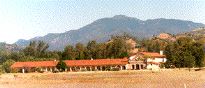
Pfeiffer Big Sur
State Park was established in 1933, and is the
most popular park on the Big Sur Coast. There
are more than 200 drive-in tent camp sites with
tables, fire pits and cooking grills in the
redwoods and along the Big Sur River, an
exciting complex of trails, and an interpretive
nature center. The campground has hot showers
and restrooms, large group campgrounds, campfire
center, store, laundromat, and Park Rangers
conduct daily nature programs during the summer.
Make reservations through 1-800-444-7275. There
are 62 modern, woodsy, cottage units in the
redwoods at the Big Sur Lodge in the park. Call
831 667 2025 – or visit:
www.pelicannetwork.net/bigsur.lodge.htm
|
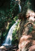
Pfeiffer Falls
Photo by Jack
Ellwanger
|
In Big Sur River Valley,
from Pfeiffer Ridge, which flanks the ocean, to the
Ventana Wilderness, Pfeiffer Big Sur State Park is a rare
and wonderful place.
It is the heart of Big Sur –
where the first American pioneers settled.
It was the most hospitable place
– river, valley, redwoods. Settlers farmed and made honey
with the abundance of wildflowers.
The park is 1,006 acres of old
growth redwoods, magnificent mountain views, granite
river gorge, condors and rich history.
|
|
Pfeiffer Big Sur State
Park is a hiking paradise. Within the park itself
there are almost 11 miles of trails of varying
degrees of difficulty. From the short Nature Trail,
to the vigorous mountain trails into the
magnificent Ventana Wilderness, there is a
bountiful variety of trails. One of the most
popular trails follows Pfeiffer-Redwood Creek to
the 60-foot high Pfeiffer Falls and features
exceptionally fine redwood groves.
|
|
Pfeiffer Redwood
Creek Trail to the
falls is through a lively, dense old redwood grove.
It is an instructive trail. You can see how a
redwood forest makes its own soil and understory.
The creek cuts through alluvial deposits, and you
can see how the valley built up over the
eons.
|
|
|
Pfeiffer Falls
Trail
This 40 to 60 minute stroll along Pfeiffer Redwood
Creek features some of the finest redwood groves in
the Big Sur region.
Expect steps in the steeper sections and a
number of scenic bridges across Pfeiffer Redwood
Creek.
|
|
The 60 foot high waterfall at the end of the
trail is a scenic highlight. A wooden platform at
the base of the falls is a fine place to rest,
meditate or have a picnic lunch – 0.7 mile one-way
from the Lodge.
|

|
|
|
Page Twelve
|
|
Nature
Trail
This self-guiding trail can be toured in about 30
minutes and is a 0.7 -mile round trip from the
Lodge. The trail offers a fine opportunity to see
many of the plants that are native to Big Sur.
Printed nature guides are available at the western
end of the trail, between the Lodge and the Ranger
Station. Suitable for wheelchairs.
|
|
Valley
View
From either the beginning of the
Pfeiffer Falls trail, or from the base of
the falls themselves, you can climb
through the oak woodland to Valley View
Overlook. The view from this vantage point
includes much of the Big Sur Valley, Point
Sur and Andrew Molera State Park. The
outlook is a mile one-way from the Lodge
and 0.5-mile from Pfeiffer Falls.
Oak
Grove
The great beauty of Big Sur is due in
part to the variety of its natural
ecosystems. The Oak Grove trail
exemplifies this as it travels through a
number of plant communities.
From deep redwood groves to open, oak
woodland, and to hot, dry chaparral, this
60 to 80 minute hike makes it possible to
enjoy the many different faces of Big Sur.
It is approximately 3 miles round trip
from the Lodge.
Big Sur
River Gorge Trail
The wild and scenic,
completely untamed, Big Sur River begins
high in the Santa Lucias by the Ventana
Cones. It drains more than sixty square
miles of raw coastal mountain watershed
and plunges down a narrow granite gorge
into the park and lazes toward the
ocean.
Huge boulders brought by the river are
flung around the canyon in great artistic
array. Pebbles brought down the undammed
river provide spawning and rearing habitat
for steelhead, a seagoing trout. Sands
brought by the river spread out along the
banks by the redwoods making a unique and
pleasing scene.
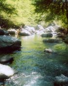
Photo
by Jack Ellwanger
Manuel
Peak
At the top, you will get one of the
loveliest, sweeping views of the Ventanas.
Getting there will test your conditioning,
though. This steep, one way trail, is more
than 5 miles, averaging nearly 12%
gradient, rising more than 3,000 feet.
Plenty of ticks and poison oak.
|
|
|
 Photo
by Margie Whitnah Photo
by Margie Whitnah
|
Buzzard’s
Roost
A moderate two-hour hike along the Park’s
western edge will take you along the river, through
shady redwoods, then through a series of
switchbacks among bay trees and tan oaks to the
chaparral-covered top of Pfeiffer Ridge.
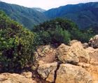
Photo by Margie
Whitnah
Up there is a magnificent panoramic view of the
Pacific Ocean and the Santa Lucia Mountain Range.
Interestingly, on the ridge redwoods grow alongside
chaparral plants. The unusual soils made of
sandstone and shale, and the rare microclimate
formed by the cool ocean breeze mixing with the
warm valley air, create a fascinating array of
plants – dwarf redwoods with chamise, wheat leaf,
ceanothus, yerba santa and manzanitas side by
side.
The entire Buzzard’s Roost loop is a 5-mile
round trip from the Lodge.
|
|
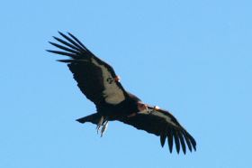
Photo by Margie
Whitnah
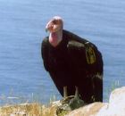
Big Sur is
Condor Country
The whole Big Sur Coastal range is great condor
habitat. Hikers can expect to see these avian wonders
from most trails. Recently, condors began feeding on
deceased marine mammals. This provides an excellent
clean-up service, and is an important resumption of their
historic feeding practice. Marine mammals killed by
orcas, or dead by natural causes are dietary favorites.
All condors in the Big Sur region have been reintroduced
by the Ventana Wildlife Society. The last 15 in this
region were captured in 1985. Now there are more than 26
here. They were bred in captivity. Three pair are
nesting, and one produced a chick in the Spring of 2007.
It is the first condor chick born in the wild in more
than 100 years.
Page Thirteen
|
|
Page Fourteen
|
|
Page Fifteen
|
|
Julia
Pfeiffer Burns
37 miles south of
Carmel’s Rio Road
$8 Park entrance fee per car
Plenty of picnic sites along the Big Sur River
Almost
2,000 acres of coastal, canyon and mountain greatness, Julia
Pfeiffer Burns State Park is a fantastic place and a perfect
introduction to Big Sur.
Julia Pfeiffer Burns State Park is 11 miles south of
Pfeiffer Big Sur State Park on Highway One and covers 7
miles of exquisite coast with many coves.
Within the park are idyllic trails, waterfalls,
underwater parks, historical gems, riparian hardwood
forests, mystic redwood groves with ancient growth trees,
and deliriously beautiful scenery.
|
McWay Falls
Trail – A short walk through a tunnel
and along the cliff of a cove to the Brown’s
Waterfall House site. Entrance to Julia Pfeiffer
Burns McWay Falls Trail is 11 miles south of The
Big Sur Lodge and Pfeiffer Big Sur State Park on
Highway One.
|
|
Canyon Trail
– A third-mile walk into old growth redwoods
to waterfalls of the South and North Forks of McWay
Creek.
|
|
Ewoldsen Trail
– A 4.5-mile loop hike through old growth
forests to the top of the coastal range.
|
|
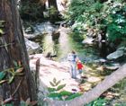
Partington
Cove – A steep trail to a tunnel and a
historic cove, and also to the big rock beach where
Partington Creek enters the sea.
|
|
Tan Bark Trail
– A 3.2-mile hike through ancient forests,
mountain springs to a mountain top with spectacular
views of the coast- a 6.4-mile round trip
hike.
|
|
Canyon Fall
Photo by Jack
Ellwanger
|
|
Canyon
Trail and
Ewoldsen
Trail
A 4.5-mile steep hike to the top of the
Coastal Range.
From its beginning at the parking area
of Julia Pfeiffer Burns State Park, the trail ascends along
the McWay Creek through a redwood-forested
canyon.
The Canyon Trail continues beyond the
intersection of the Ewoldsen Trail. At its end you face a
high waterfall, an ancient redwood embracing a large granite
boulder and steep canyon walls graced with ferns.
The Ewoldsen Trail ascends the canyon before the Canyon
Trail’s waterfall. For the first half of the trail you walk
along McWay creek in a water wonderland with many water
cascades.
The trail is well-marked, is
well-maintained, and excellent bridges cross the creeks.
After a mile up the trail, you encounter a two-mile loop.
After a quarter mile along the Canyon
Trail, the Ewoldsen Trail intersects the Canyon Trail, then
branches off to the right and up slope.
It maintains a steady ascent out of the
canyon, crosses creeks deep in redwood forests, rises
through sunny oak and chaparral scrub. At times, you’ll see
lots of butterflies and wildflowers.
Ewoldsen Trail is a deep,
quintessential Big Sur watershed experience.
Evidence of the wondrous powers of
regeneration is all around the hiker for most of the trail.
|
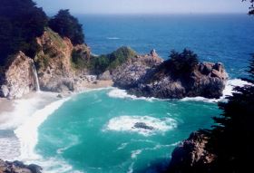 McWay
Falls and Saddle Rock McWay
Falls and Saddle Rock
Photo by Jack
Ellwanger
Page Sixteen
|
Julia Pfeiffer Burns State Park
experienced a massive slide that disconnected
the Tan Bark from the Ewoldsen Trails. There are
no immediate plans to re-connect the trails.
|

Ewoldsen Trail often crosses McWay Creek’s North
and South Forks and their tributaries.
|
This park is a favorite condor viewing
area.
|
|
Page Seventeen
|
|
Page Eighteen
|
|
|
The Partington
Canyon watershed
showcases the distinctive riparian woodland of
Central California’s coastal watersheds. The summer fog
forms from the clash of warm land air and cold water
upwelling from deep offshore canyons.
Partington Creek frolics rambunctiously around huge
boulders, pools, rapids and cascades. Giant sycamores and
redwoods regally congregate around seeping, bubbling
springs.
|
Partington
Cove
Partington has two
great hikes. First, is a two-mile loop to the
ocean. It begins at an iron gate along Highway One
– nine miles south of Pfeiffer Big Sur State Park,
and 35 miles south of Carmel’s Rio Road.
It is a fine trail down to the
beach, but steep. The trail goes down to the
Partington Creek’s graceful little exit to the
Pacific Ocean. Then you back track up the creek to
a bridge (there’s an outhouse nearby). Over the
bridge you soon come upon a 100-foot tunnel to
Partington Cove.
|
|
|
This is like Fantasy
Island, only better, as this is real. Mules used
to haul wagons of tanbark through here.
|
|
The picturesque little cove is
home to sea otters and seals, very clear waters and
a kelp forest. It is a wildly aquatic experience.
On the point is an old hoist stanchion, formerly
used for loading cargo, lumber and tanning bark.
The iron eyes for tying up the ships are still in
place. You can imagine pirates and bootleggers
rousting about.
|
|

Pacific sunset seen at Partington
Page Nineteen
|
Tan
Bark Trail
|
The second Partington hike begins on the east
side of Highway One. Bring drinking water and maybe
also a flashlight, just in case. For the first
third of the trail there is plenty of good fresh
water. Not so, later.
Initially, the trail can be confusing. If you
start out going to the left of the creek, you will
have a lovely saunter in the redwoods, and come
upon an idyllic picnic spot — a boulder hanging
over a wide sparkling pool, with a waterfall in a
cathedral of Sequoia sempervirens. But, this
is the wrong trail. It dead ends at a cliff.
The real trail, the Tan Bark, goes along the
south side of Partington Creek, and then up. It
branches to the left in three spots, leading into
forests deeper within the canyon. It stays right,
ascending the canyon. There are a few signs. The
Old Coast Trail crossed here, and surely the ghost
of poet Robinson Jeffers is about.
The trail follows a 2,000-foot rise in elevation
over 4 miles through a redwood canyon.
Then the Tan Bark Trail climbs along a roaring
stream, waterfalls, springs bubbling out of
hillsides, and into thick stands of exotic oaks,
venerable madrones and manzanitas.
The McLaughlin Memorial Grove, on a ledge in a
nook of the forest, high above the raucous creek,
is awesome. The Grove is home to redwoods with
spiraling bark.
In several places, particularly farther uphill
in the Swiss Camp area, you see arduous stonework
made 80 years ago. Gunder Bergstrom, who lived here
in the 1920s, did the work, and it shows a deep
love for the area. The stone bridge he built is
like a little human cameo to accent a wish to
preserve one of nature’s finest settings. The
bridge allows the place to be appreciated and
protects the stream environment from human
impact.
|
|
|
You cross
streams and pass springs that bubble up in fern
groves, and out of the sides of the canyon. The
trail switches back into sycamore, then tanoak and
into unusual old growth redwoods.
The trail
hugs the canyon slope which is chaparral-studded
with colorful madrones and manzanitas and piercing
views of the sea, across to Partington Ridge, and
up into the Santa Lucias. You ascend on a
moderately steep gradient, about 12 to 14%,
continuing up until you are 2,000 feet above the
ocean, and can see it through redwoods. It looks
like another planet. On summer afternoons you can
watch huge fog banks flow toward the shore far
beneath.
Near the
top you encounter a well-graded road. This can be
your return trip. It is considerably shorter,
descending to Highway One about three-quarters of a
mile south of the point at which you started. So,
you will have to hike up the highway to get back to
your car.
Up here you feel you are at the top of the
world. From here the coastal views are sweeping and
the sea is endless. The view east is to the Santa
Lucia high country.
You find the Tin House at the top. It was built
by Lathrop Brown, who lived in the grand home
across the cove from McWay Falls. Brown was a high
official in the U.S. State Department during
Franklin D. Roosevelt’s presidency. Oddly, the
house up here was built of tin salvaged from gas
stations before World War II. Its design is
strange, too. Even though the Tin House is situated
atop a 2,000-foot mountain, practically on top of
the ocean, with unobstructed, majestic vistas, it
has no view from inside the house to the west.
|
|
|
Page Twenty
|
|
Limekiln
State Park
What fascinating and rewarding experiences this
state park readily offers in the heart of Big Sur.
Limekiln State Park is located 36 miles south of
Pfeiffer Big Sur State Park, centered two miles
south of Lucia and two miles north of the eastbound
Nacimiento-Ferguson Road turnoff.
Visitors of almost all ages will delight in
wandering the short, fairly easy trails, while
being awed by the stately redwoods, free-flowing
creeks, a royal waterfall, historic limekilns, and
an enjoyable stone beach. Longtime lovers of
natural and cultural history may find themselves
enthralled with this park, and even the uninitiated
might, too, getting their feet wet, perhaps
literally with creek crossings.
Visitors with foresight may arrange to camp in
one of the 33 campsites for an overnight or
extended stay. Others with less time available can
easily explore the four highlighted areas in a
couple hours time, covering less the “less-than a
few” total miles on the relatively level
trails.
After driving down the short eastbound road from
the south end of the Limekiln Bridge on Highway
One, there is day-use parking available and also
restrooms. Most visitors may prefer to head
northeast up Limekiln Canyon, hiking out through
the campgrounds to the three redwood-lined trails.
Doing that, leaves the fourth destination, Limekiln
Beach, for last.
Though children may imagine themselves to
exploring uncharted redwood groves and creeks, they
can be reminded that long, long ago, as difficult
as it was to access these intimidating canyons and
cliffs, indigenous people were able to inhabit or
visit these formidable areas. By the 1800’s,
foreign explorers, hunters, hardy American pioneers
and homesteaders managed to journey here by trails,
too. Some were drawn by the natural resources,
particularly the timber and the extracting of
limestone to manufacture lime, used to make cement.
In the late 1800’s, the area near Limekiln Beach,
Rockland Landing, was a vital hub of activity for
materials and goods coming and going on
schooners.
|
|
Limekiln
Trail
At the end of the campground area, the trail
leads to a wooden bridge which crosses Hare Creek.
(Lou G. Hare, 1867-1921, was an early Monterey
County Surveyor.) After crossing the bridge, one
soon comes to signs designating the Hare Creek
Trail going to the right along Hare Creek (0.3
miles), the limekilns (0.5 miles) and Limekiln
Falls (0.4 miles).
Since this trail description is intended to lead
to the kilns, one can stay to the left following
Limekiln Creek’s West Fork until reaching the
junction where Limekiln Falls Trail and Limekiln
Creek meet. Staying to the left on the trail to the
kilns, one goes about a third of a mile until
reaching a fenced-in area which reveals four
towering brown steel limekilns, with their ovens
and stonework at their bases. In the heyday of
Rockland Lime and Lumber Company, cut redwoods went
into the ovens to heat the fires, as limestone and
firewood were put into the top. That purified the
lime by a process known as slaking or calcining, by
using slow, regulated burning to produce the lime.
Then, the slaked lime was shipped in barrels to San
Francisco or Monterey for cement-making, among
other uses. The kilns are now roped-off for
visitors’ safe viewing.
|
|
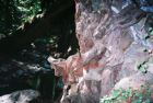
Limekiln Falls
Trail
Retracing the trail along the Limekiln Creek’s
West Fork brings hikers back to the junction with
main stem of Limekiln Creek where a sign points the
way to Limekiln Falls. Depending upon the water
level, pant legs may need rolling up and water
sandals may prove useful, since this next quarter
mile or so will involve several creek crossings,
including some with footbridges.
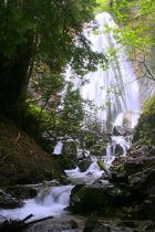 Limekiln
Falls Limekiln
Falls
Photo by Margie
Whitnah
|
|
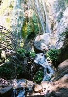
Limekiln Falls during
drought
Photo by Jack Ellwanger
But the steps, crossings, and any wet shoes will
be well worth the adventure, especially when the
fall’s roar comes into earshot and then the
spectacular 100-foot waterfall spilling over the
limestone cliff comes into view. Even the
refreshing mist can be a bonus. Once rested and
ready, the trail and creek crossings can be
carefully retraced, returning to the sign at the
third branch of these canyon hikes, “Hare Creek –
.3 miles.”
|
|
Hare Creek
Trail
Hare Creek trail visitors follow along the left
side of Hare Creek while hiking to its “End of
Trail” sign beside a fallen redwood log. The canyon
walk follows along the charming Hare Creek and its
pools which sometimes are home to steelhead. The
redwoods host sorrel, ferns, and other delightful
vegetation in their moist, fragrant, shadows.
Hare Creek Trail
Photo by Jack
Ellwanger
At the end of the Hare Trail, by a rock wall, a
cascade under a fallen redwood flows into a broad,
fern-rimmed pool. It’s a wonderful place to rest
and appreciate Mother Nature before hiking back
along the trails to the campground and out to
Limekiln Beach.
Pool and fall at end of Hare Creek trail
Photo by Jack
Ellwanger
|
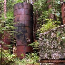
Photo by Margie
Whitnah
|
Limekiln
Beach
Limekiln Beach, located under the Highway One
bridge, is accessed by hiking out the dirt road,
just west of the campground and parking lot. One
can stroll a long way following the curve of the
beach on the sand and rounded stones, trying to
imagine the busy shipping port of yesteryear,
Rockland Landing, with its barrels of lime going
out and commercial supplies coming in. Or, maybe
one can just watch the ocean waves going out and
coming in, as children on the shore are dreaming up
their own stone structures and cementing them with
sand.
|
Ancient redwood remnant along Limekiln Creek
By Jack
Ellwanger
|
|
Page Twenty-One
|
|
Big
Sur History
Big
Sur
began 35 million years ago, 14 miles deep in the
earth off the coast of Mexico. Tectonic plates
rubbing against each other moved these mountainous
rocks north. Five million years ago they pushed up
out of the ocean to form an island that is now Big
Sur. The Santa Lucia range, which includes the
Ventana Wilderness of today, is young and
precocious.
Indians
Before colonization by the
Spanish Empire, indigenous people populated the
southern Monterey Bay area including the Salinas
Valley, Monterey Peninsula, Big Sur coast, and
Santa Lucia Mountains. Throughout the years, these
people have been identified by different tribal
names including Ohlone, Costanoan, and Esselen.
Their descendents today chose a legal name that
reflects that identification diversity.
Today, the Ohlone/
Costanoan-Esselen Nation is seeking federal tribal
recognition.
The Esselen territory
encompassed the interior of the Santa Lucia Range
and portions of the Big Sur coast. The Spanish
colonization and mission building was to change
every aspect of indigenous peoples’ lives in
California, and the Monterey area was no exception.
The forced relocation of Native Americans decimated
their culture and numbers. In 1939 the last fluent
speaker, Isabel Meadows, of the traditional local
languages died.
But the culture and people
survived and thrive today. Some Esselen escaped the
missions and hid in caves in Carmel Valley. A few
became trappers for Russians, later cattle drivers
for the Spaniards.
Some re-entered American
society as Mexicans. These few have kept their
Native American traditions alive, and continue as
stewards of the Santa Lucia Mountains and coastal
valleys. Salinan Indians thrived in the San Antonio
Valley, Salinas Valley and throughout the Santa
Lucia range from Carmel Valley to Paso Robles, and
to Morro Bay on the coast.
|
|
|
Before the arrival of
American pioneers, the Big Sur region was settled
during the Mexican period.
The development of two
very large land grants from the 1830s, El Sur and
San Jose y Sur Chiquito, were north of the park but
led to settlement farther south. The culture of the
coast during the nineteenth century was
predominantly Hispanic. To this day, an Hispanic
thread continues to weave throughout the area’s
history and culture.
|
|
The first European
immigrants to settle permanently in Big Sur were
Michael and Barbara Pfeiffer. Their son, John, and
his wife, Florence, homesteaded a parcel on the
north bank of the Big Sur River. Like most settlers
of that era, they spoke Spanish. John was more
comfortable speaking Spanish than
English.
When John and Florence
Pfeiffer settled the area, they found that others
were drawn here by the fishing, hunting and
exploring. The Pfeiffer’s let the visitors stay at
the ranch. John cared little for money and insisted
that visitors not be charged.
Florence, however, became
increasingly disgruntled by the number of drop-in
visitors, the cost and workload she bore for their
care, and the rudeness of those who took the
Pfeiffer’s hospitality for granted.
Finally, her patience
reached its end when she saw a visitor beating his
mule. She told the bully, who had stayed without
even a “thank you” to the Pfeiffer’s, that he
couldn’t treat the mule like that on her property.
From that time on, visitors had to pay for their
meals, beds and horse feed, and were forbidden to
mistreat an animal. John was disappointed about
charging guests, but acquiesced to his wife’s
wishes. That was the beginning of the Pfeiffer
Ranch Resort, now the location of the Big Sur
Lodge.
In 1933, the Pfeiffer’s
sold and donated 680 acres of their ranch to the
State of California. This became Pfeiffer Redwood
State Park in commemoration of the family’s
contribution to the pioneer history of the Big Sur
region and of their gift to the state. Like most of
the Big Sur settlers, John Pfeiffer was a
naturalist and conservationist, and he stipulated
that the ranch be saved as a park.
|
|
|
Page Twenty-Two
|
|
|
Getting
Around Big Sur
|
The most
asked question by visitors is, “Where is Big Sur?”
The answers usually are, “It is a region 90 miles
long and 40 miles wide;” and, “It is not a place.
It is a state of mind.”
However you
like to refer to this unique slice of geography,
Big Sur is a rare place with many faces.
|
Like an
island, the northern half of the Santa Lucia coastal
mountain range has evolved an unusual ensemble of
geologic and botanical communities. Nearly 200 plants
have their northernmost habitat here, and, similarly,
nearly that many have their southernmost habitat here
also. You will see Yucca Whipplei from the Mexican
high desert, and Sequoia sempervirens from the
subarctic peacefully and luxuriantly prospering here.
|
Today,
Big Sur is a coastal wilderness. It is as
pristine as could be imagined for its 200,000
acres and 90 miles of premium California coast.
It is a grand testimony to the human craving for
appreciating this raw, bold beauty that it has
been protected. A highway was constructed in the
1930’s just to see this boldly beautiful natural
setting. The road in this setting has come to
define Big Sur for most people. But, the will of
the pioneers to conserve the remarkable region
has prevented Big Sur’s destruction by
development.
|
|
Margaret
Owings,
who created Friends of the Sea Otter, said,
“There’s something about Big Sur that puts
people in their place. Something they have to
come back to, because it does something to you.
And it gives you a responsibility to keep it
like this.”
Ninety-five
per cent of Big Sur is the fold-upon-fold of
Ventana Wilderness, each a unique watershed,
rare biology, incredible geology that most
people never see. In the coastal mountain
canyons that vein the intricate quilt of
watersheds, such as seen when hiking the
Partington watershed, one gets an inside peek at
this wondrous country.
In
Pacific Ocean coves, sea otters and elephant
seals have been rediscovered after their
announced extinction.
You can
access nearly every distinctive habitat here
from Highway One. The U.S. Post Office, sort of
the “official” location of Big Sur, is two miles
south beside an interesting assortment of
businesses.
|
People
of Big Sur
Some of the
finest novelists, painters, poets and photographers have
found inspiration for their works in Big Sur’s Coast.
Robert Louis Stevenson, Mary Austin, Jack London,
Sinclair Lewis, John Steinbeck, Robinson Jeffers, Lillian
Bos Ross, Jack Kerouac, Henry Miller, Edward Weston,
Ansel Adams all came here and enriched their
palettes.
For intellectual
stimulation and a literary orientation of the meaning of
Big Sur, visit the Henry Miller Memorial Library. You
will find it in a redwood grove through an Alice in
Wonderland rabbit hole four miles south of the Big Sur
Lodge. The director, Magnus Toren, speaks many languages,
has sailed around the world, and keeps a provocative
bookstore.
|
|
Page Twenty-Three
|
|
Pfeiffer
Beach hosted
movie stars
|
Pfeiffer
Beach, where Richard Burton and Elizabeth filmed
Sandpiper and where Burt Lancaster and
Deborah Kerr filmed their famous beach scene in
From Here to Eternity, is 3.3 miles from the
Big Sur Lodge. Drive south (and up the hill) 1.1
mile to Sycamore Canyon – the road is not marked.
There is a sign that reads, “Narrow Road – RVs and
Motor Homes not recommended.” Turn right and slowly
drive two miles all the way through the canyon to
the U.S. Forest Service parking and restroom
facility. Pay $5 per car.
|
|
Photo by Margie
Whitnah
Pfeiffer Beach
photographed in 2001 when outrage around the world
followed news of the U.S. Navy intent to use Big Sur as a
practice facility for jet fighter bombing.
Page Twenty-Four
|
|
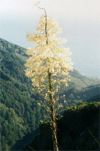
Wildflowers
and Native Plants of Big Sur
Big Sur’s
mild climate, rare geology and isolation conspire
to provide habitat for a great diversity of plant
communities. Almost half of all plants in
California have a home here. Many plants have their
only natural home here. Nearly 200 plants have
their southernmost or northernmost home here.
|
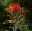
Indian Paint
Brush
Photo
by Margie Whitnah
|
|
|
Our area of
the Pacific Ocean is transitional between the
Southern California and Oregonian zones. Water
temperatures vary by the influence of each zone and
the deep underwater canyons.
|
|
Cold water
from deep offshore canyons wells up to meet warm
air and create vast fog masses.
|
Yucca
whipplei
|
|
|
Page Twenty-Five
|
|
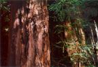
Redwoods
Redwoods
thrive here because of the
fog.
They grow on the
valley floor along the river, and on the north
facing slopes. Along the streamway grow
cottonwoods, white and red alders, western
sycamores, big leaf maples and tall willows. Live
oaks grow on terraces.
Big Sur is the
southernmost reach of Sequoia Sempervirens –
coastal redwoods – but there are many glorious
examples here of these grand trees. In Pfeiffer Big
Sur State Park, near the group picnic ground, one
of the trees, Colonial Tree, is 27 feet in
circumference. Closer to the Lodge, there is a
grove of 1,200 year old redwoods called the
Proboscis Grove.
|
|
John Steinbeck called California Redwoods,
“Ambassadors from an ancient age.”
|
|
Much of the virgin
redwood in the area was cut when the Ventana Power
Company built a sawmill at the turn of the century.
Although the sawmill was abandoned by the Power
Company in 1906, the Pfeiffer’s continued to use it
intermittently. Florence got the mill back in
running order to cut lumber for guest cabins. The
sawmill ran again during the early 1920s, providing
cut lumber to build housing for people working on
Highway 1.
|
|
|
Big Sur’s remoteness and
rugged terrain helped save some of its natural
resources. Harvesting trees in steep canyons was
difficult, then transporting them to an ocean cove
to be loaded on a ship required complex logistics
and much capital.
Harvesting Big Sur’s
natural resources was made possible in large part
by the elimination of the Native People.
Standing near the southern
limit of their range, coast redwoods are found in
areas along the Big Sur River and smaller creeks in
the park.
Like a royal pageant
through the valley, they lend a serenely grand aura
to the atmosphere. Even when the 200-site
campground is full, there is a quiet amidst the
trees. When a chickadee or a warbler sings, its
melody echoes along the river. A sage and
blackberry aroma wafts through the
Valley.
|
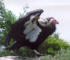
Photo by Phil
Adams
|
McWay Rocks seen from atop Ewoldsen Trail
Photo by Jack
Ellwanger
|
|
Page Twenty-Six
|
|
Back
Country
Wonderful experiences await hikers
east of the coast. Pristine landscapes that look very much
like they did before Europeans arrived. Vast oak savannahs
and magnificent vistas of the Ventana Wilderness and Santa
Lucia Mountains are part of the early California
treasures.
|
|
Hiking in San Antonio Valley
Photo by Margie
Whitnah
|
Mission San Antonio de Padua
Photo by Jack
Ellwanger
|
|
|
The
Rich Marine Environment
Early European hunters
almost entirely eliminated sea otters, gray whales,
red abalone and elephant seals along the whole
Pacific coast. This tradition carried through with
the Americans as the Big Sur region was plucked
almost completely clean of redwoods and
tanoaks.
Elephant
seal pups at San Simeon are part of one of nature’s
most spectacular comebacks. Less than 25 years ago,
this incredible mammal was thought to be extinct. A
few survived and colonized a Mexican island. At the
end of the 1980s they began colonizing in Big Sur,
and today there are more than 8,000 of these
amazing seals on our South Coast.
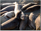
Photo by Jutta
Jacobs
Elephant Sea Friends of the
Photo
by Margie Whitnah
|
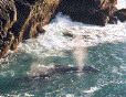
Whales in McWay
Cove are occasionally seen. During the
northern migration, two cows bring a
newborn calf up the coast. The trip is
dangerous as orcas hunt the California
gray whales to kill the calf. The cows
seek the cliffs to help them protect
against orca attacks.
More than 20,000
gray whales make the Arctic to Baja
migration and back each year. It was not
long ago that they were hunted by humans
to near extinction.
|
Songbird
Banding
On Saturday
mornings between Memorial Day and Labor
Day, you are invited to observe how
songbirds are studied.
At the Big Sur
Ornithology Lab (BSOL), the Ventana
Wildlife Society (VWS) records data
about songbirds.
|
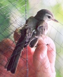
Photo
by Margie Whitnah
|
BSOL
biologists, staff, interns, and
volunteers recognize what a unique
place Andrew Molera State Park is for
the hundreds of species of migratory
bird populations who rest and breed
there. These people are profoundly
dedicated to monitoring and researching
the birds’ health and distribution of
not only the migratory birds, but most
importantly, the common birds in the
area. The ongoing mist netting station
where bird banding is performed at the
lab is a primary method in carrying out
the BSOL team’s efforts toward bird,
wildlife, and habitat
conservation.
The Lab hopes
that by sharing in the learning,
visitors will be inspired to increase
their support for wildlife
conservation, respect for Nature’s
wonders, and protection of our
environment’s biological diversity. The
Lab welcomes visitors to their bird
banding demonstrations.
You may visit
on Saturday mornings from Memorial Day
to Labor Day, between 7 a.m. and 12
noon. It is free to the
public.
|
Big Sur is a
wondrous place. So much of nature can be found
here. But much of yourself can be found here,
too.
An incredible effort
has been made by local citizens and state,
county and national agencies to preserve the
natural wonders of Big Sur. It has not been
easy. But the effort is intended for you to
enjoy and learn from it. So indulge your senses,
and stay in touch.
|
|