|
|
|
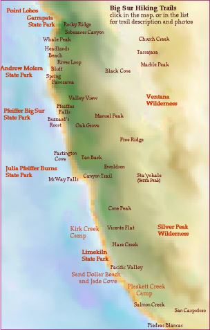
2 miles South of Rio Road $8 Park entrance fee per car Free to Guests of Big Sur Lodge Click here for Point Lobos Print Version
|
||||||
Garrapata |
|||||||
|
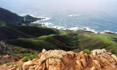
Garrapata State Park has a wonderfully scenic stretch of coastal area that lures Big Sur travelers to stop and visit. Garrapata is only 7 miles south of Carmel Valley Road and 14 miles north of Andrew Molera State Park. Many visitors take time to linger a bit, enjoying the classic Big Sur shoreline here with its rugged rocks, waves surging and crashing, kelp beds undulating, sea lions barking, gray whales |
migrating, seabirds diving and wildflowers thriving. However, many fewer visitors know about, nor take the time to hike, the marvelously rewarding trails of Garrapata State Park. There are two longer inland trails on the east side of Highway One and also an easy, 2-mile loop trail along the coastal bluffs. |
||||||
|
|||||||
|
|||||||
Click here for Molera print version
|
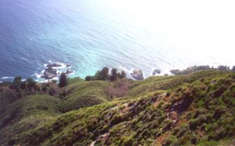
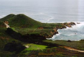
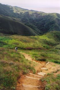
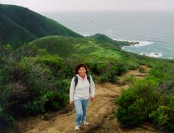
Seven and a half square miles of wilderness, 21 miles south of Carmel, along the ocean, into the mountains, and complete with a wild and scenic river – Andrew Molera State Park is a great favorite for outdoor enthusiasts. The entrance is three miles south of Point Sur and 4.5 miles north of Pfeiffer Big Sur State Park. An $8 per car fee is collected at the parking lot entrance. Guests at the Big Sur Lodge have free entrance to all Big Sur coast state parks during their stay at the Lodge. A variety of interesting trails, most with incredible views, and a 24-site walk-in campground make Molera an engaging place to stay awhile. The park is dissected by the Big Sur River. Long stretches of marine terrace, vast sweeps of beach, expansive scapes of wildflowers, hillsides of coastal scrub, and deep old-growth redwood and oak forests make Molera an imagination-bending experience. |
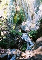
How the pristine Big Sur River winds from the Ventana highlands to the sea is a rare California natural prize. Big Sur River has no dams, nor any man-made diversions. It is thoroughly untamed and wonderful, it is instructive and magical all at once. How it enters the Pacific at the Headlands is a raucous and lovely place. This is one of the liveliest wild bird encounters on the whole Pacific coast. And, all along the river you walk among one of the most precious and populated songbird habitats anywhere. Molera is a treasure, and there are many trails inviting you in. Among its many attributes, it is a very rewarding birdwatching area (Molera bird watching). Across Highway One from the Molera entrance, the 10-mile Old Coast Road begins its backcountry wind to the Bixby Bridge through a redwood forest. |
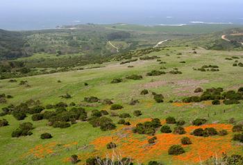 Photo by Margie Whitnah |
|
Along the lower Big Sur River, the trail offers rare encounters with many bird species: chickadees, bushtits, warblers and many other songbirds (see our Songbird Banding at Big Sur Ornithology Lab), belted kingfishers, red-shouldered hawks, kites, kestrels, and golden eagles. |
|
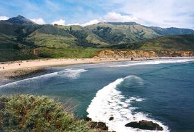 Photo by Margie Whitnah |
|
|
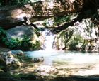
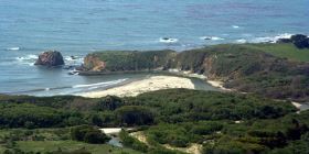
Beach Trail Loop Beginning at the parking lot area’s picnic site, cross the river at the footbridge, which is constructed annually before Memorial Day and removed after Labor Day. Beach Trail begins on the right at the trail fork. Follow it to the beach. Before reaching the beach the Creamery Trail junctions with the Beach Trail. Continue on to experience one of California’s most scenic and dramatic beaches. Molera Beach spans 2.5 miles from the Headlands at the Big Sur River lagoon at the river’s mouth, south to Cooper Point. |
To the north there is whimsical collection of driftwood, and great waves to the south. It is beautiful. Creamery Trail In this trail loop you might see bobcats and coyotes, and probably will see lizards, rabbits, and deer. |
Mouth of Big Sur River
Photo by Margie Whitnah
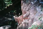
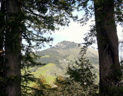
Once at the ridge, an usual place for towering redwoods, hikers may be amazed even more to view the details of Pico Blanco face on, much closer, framed by the erect trunks of redwoods and spreading limbs of ancient oaks. The ridge itself is home to yucca whipplei, a huge dead tree trunk with a portion that looks like art sculpture of a whale’s fluke, plus stunning views in all directions. The extensive panorama includes the Big Sur coast and Santa Lucia ranges as far as visibility allows and, nearby, the canyons of both the Little Big Sur and Big Sur River watersheds.
|
|
Pfeiffer
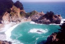
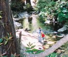
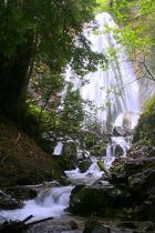
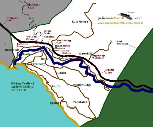
Big Sur State Park Pfeiffer Big Sur State Park was established in 1933, and is the most popular park on the Big Sur Coast. There are more than 200 drive-in tent camp sites with tables, fire pits and cooking grills in the redwoods and along the Big Sur River, and an exciting complex of trails, and an interpretive nature center. The campground has hot showers and restrooms, large group campgrounds, campfire center, store, laundromat, and Park Rangers conduct daily nature programs during the summer. Make reservations through 1-800-444-7275. There are 62 modern, but rustic and woodsy, cottage units in the redwoods at the Big Sur Lodge in the park. Call 831 667 2025 – or visit: Big Sur Lodge Nature Trail Pfeiffer Redwood Creek Trail to the falls is through a lively, dense old redwood grove. It is an instructive trail. You can see how a redwood forest makes its own soil and understory. The creek cuts through alluvial deposits, and you can see how the valley built up over the eons. |
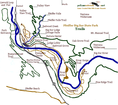
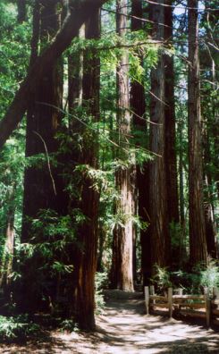 Pfeiffer
Falls Trail Pfeiffer
Falls TrailPhoto by Jack Ellwanger
|

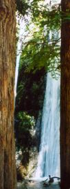
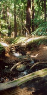
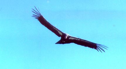
Photo by Cheryl Leeves